TYPE:
SENSOR
LAYER:
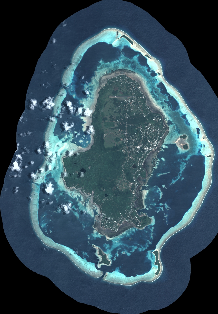
DS_PHR1B_202211222205465_FR1_PX_W177S14_1018_02546
FORMAT:
DIMAP
RASTER:
image/tiff
General Information
Map Name
Geometric Processing Level
Radiometric Processing Level
BASIC
Image dimensions
Number of columns
9854
Number of rows
14187
Number of spectral bands
4
Dataset framing
Vertice
Longitude (DEG)
Latitude (DEG)
Row
Col
#1
-176.3042804337083
-13.15600316586851
1
#2
-176.1187527126033
-13.15740960168865
#3
-176.1187245361126
-13.42151148837396
#4
-176.3042850316516
-13.42037730058151
Dataset sources
PHR
Coordinate Reference System
Projected Coordinate System
Geocoding tables identification
EPSG(6.3)
Production
Production Date
2022-11-23T11:25:59.883
Job identification
6569721101-2
Dataset Producer Identification
AIRBUS DS GEO
Producer link
http://www.geo-airbusds.com
Quicklook
Copyright