TYPE:
SENSOR
LAYER:
DS_PHR1B_202209300938100_FR1_PX_E020N37_1016_00429
FORMAT:
DIMAP
RASTER:
image/jp2
General Information
Map Name
Geometric Processing Level
Radiometric Processing Level
BASIC
Image dimensions
Number of columns
1784
Number of rows
2274
Number of spectral bands
4
Dataset framing
Vertice
Longitude (DEG)
Latitude (DEG)
Row
Col
#1
20.81126872897422
37.67780834219878
1
#2
20.85352932172252
37.67787252976424
#3
20.85352848301589
37.63661119918824
#4
20.81159504904755
37.63659630703158
Dataset sources
PHR
Coordinate Reference System
Projected Coordinate System
Geocoding tables identification
EPSG(6.3)
Production
Production Date
2022-09-30T23:48:44.822
Job identification
6516269101-2
Dataset Producer Identification
AIRBUS DS GEO
Producer link
http://www.geo-airbusds.com
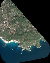
Quicklook
Copyright