TYPE:
SENSOR
LAYER:
DS_PHR1B_202209300938289_FR1_PX_E020N37_1016_00417
FORMAT:
DIMAP
RASTER:
image/jp2
General Information
Map Name
Geometric Processing Level
Radiometric Processing Level
BASIC
Image dimensions
Number of columns
6869
Number of rows
8828
Number of spectral bands
1
Dataset framing
Vertice
Longitude (DEG)
Latitude (DEG)
Row
Col
#1
20.81117477330256
37.6778198042898
#2
20.8535214645291
37.6797330361598
#3
20.85351399897852
37.63777132500285
#4
20.81157732094469
37.63618014832363
Dataset sources
PHR
Coordinate Reference System
Projected Coordinate System
Geocoding tables identification
EPSG(6.3)
Production
Production Date
2022-09-30T23:48:39.371
Job identification
6516268101-1
Dataset Producer Identification
AIRBUS DS GEO
Producer link
http://www.geo-airbusds.com
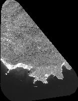
Quicklook
Copyright