TYPE:
SENSOR
LAYER:
DS_PHR1B_202209300937513_FR1_PX_E020N37_1016_00424
FORMAT:
DIMAP
RASTER:
image/jp2
General Information
Map Name
Geometric Processing Level
Radiometric Processing Level
BASIC
Image dimensions
Number of columns
1784
Number of rows
2241
Number of spectral bands
4
Dataset framing
Vertice
Longitude (DEG)
Latitude (DEG)
Row
Col
#1
20.81136144129249
37.67810142762225
1
#2
20.85353235115093
37.67692505832783
#3
20.85351619641742
37.63520563724605
#4
20.8115855353327
37.63616858962561
Dataset sources
PHR
Coordinate Reference System
Projected Coordinate System
Geocoding tables identification
EPSG(6.3)
Production
Production Date
2022-09-30T22:13:46.450
Job identification
6516267101-2
Dataset Producer Identification
AIRBUS DS GEO
Producer link
http://www.geo-airbusds.com
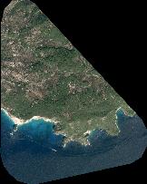
Quicklook
Copyright