TYPE:
SENSOR
LAYER:
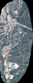
DS_PHR1B_202206291041051_FR1_PX_E003N43_1119_00350
FORMAT:
DIMAP
RASTER:
image/jp2
General Information
Map Name
Geometric Processing Level
Radiometric Processing Level
BASIC
Image dimensions
Number of columns
732
Number of rows
1829
Number of spectral bands
4
Dataset framing
Vertice
Longitude (DEG)
Latitude (DEG)
Row
Col
#1
3.862831954874873
43.73874122651632
1
#2
3.881484294511361
43.73854643751369
#3
3.881557901322794
43.70530805692475
#4
3.862830233656319
43.70553628460075
Dataset sources
PHR
Coordinate Reference System
Projected Coordinate System
Geocoding tables identification
EPSG(6.3)
Production
Production Date
2022-06-30T12:18:08.338
Job identification
6411251101-2
Dataset Producer Identification
AIRBUS DS GEO
Producer link
http://www.geo-airbusds.com
Quicklook
Copyright