TYPE:
SENSOR
LAYER:
DS_PHR1B_202205131050471_FR1_PX_E002N49_0703_00888
FORMAT:
DIMAP
RASTER:
image/jp2
General Information
Map Name
Geometric Processing Level
Radiometric Processing Level
BASIC
Image dimensions
Number of columns
1802
Number of rows
4851
Number of spectral bands
4
Dataset framing
Vertice
Longitude (DEG)
Latitude (DEG)
Row
Col
#1
2.457050569812403
49.14132169299612
1
#2
2.509684878876038
49.14229248210411
#3
2.510110872911801
49.0523272436205
#4
2.457643087711692
49.05124719248629
Dataset sources
PHR
Coordinate Reference System
Projected Coordinate System
Geocoding tables identification
EPSG(6.3)
Production
Production Date
2022-05-14T04:35:07.515
Job identification
6347035101-2
Dataset Producer Identification
AIRBUS DS GEO
Producer link
http://www.geo-airbusds.com
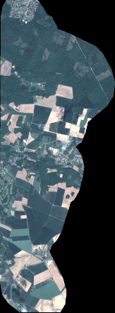
Quicklook
Copyright