TYPE:
SENSOR
LAYER:
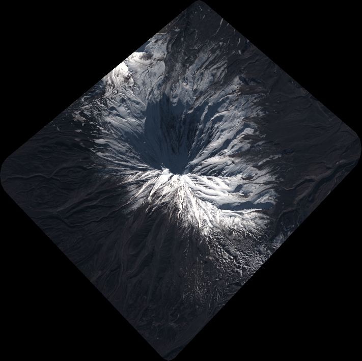
DS_PHR1A_202010120053384_FR1_PX_E158N53_0908_01432
FORMAT:
DIMAP
RASTER:
image/tiff
General Information
Map Name
Geometric Processing Level
Radiometric Processing Level
BASIC
Image dimensions
Number of columns
7821
Number of rows
7806
Number of spectral bands
4
Dataset framing
Vertice
Longitude (DEG)
Latitude (DEG)
Row
Col
#1
158.5926547728984
53.3922760153559
1
#2
158.8543373984668
53.38686610470543
#3
158.8476585742051
53.24052378378452
#4
158.5962069562421
53.2446425074612
Dataset sources
PHR
Coordinate Reference System
Projected Coordinate System
Geocoding tables identification
EPSG(6.3)
Production
Production Date
2020-10-13T12:29:53.043
Job identification
5408606101-2
Dataset Producer Identification
AIRBUS DS GEO
Producer link
http://www.geo-airbusds.com
Quicklook
Copyright