TYPE:
SYSTEM_ORTHO
LAYER:
DS_PHR1A_202001261552048_FR1_PX_W079N18_0909_01494
FORMAT:
DIMAP
RASTER:
image/tiff
General Information
Map Name
Geometric Processing Level
Radiometric Processing Level
BASIC
Image dimensions
Number of columns
5420
Number of rows
8349
Number of spectral bands
4
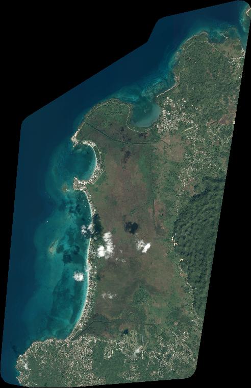
Dataset framing
Vertice
Longitude (DEG)
Latitude (DEG)
Row
Col
#1
-78.37288805478042
18.41158210390758
1
#2
-78.27038253928548
18.4101364076314
#3
-78.2727486904059
18.25940453300016
#4
-78.37516560342603
18.26083757811594
Dataset sources
PHR
Coordinate Reference System
Projected Coordinate System
Geocoding tables identification
EPSG(6.3)
Projected Coordinate System name
32617
Projected Coordinate System code
urn:ogc:def:crs:EPSG::32617
Geoposition
Upper - Left Map X Coordinate
777539
Upper - Left Map Y Coordinate
2037733
Image sampling
2 x 2
Production
Production Date
2020-10-16T07:04:47.875
Job identification
5413929201-2
Dataset Producer Identification
AIRBUS DS GEO
Producer link
http://www.geo-airbusds.com
Quicklook
Copyright